Within the scope of KA-AU project some interactive digital simulation tools have been developed in order to allow students experiment on complex phenomena.
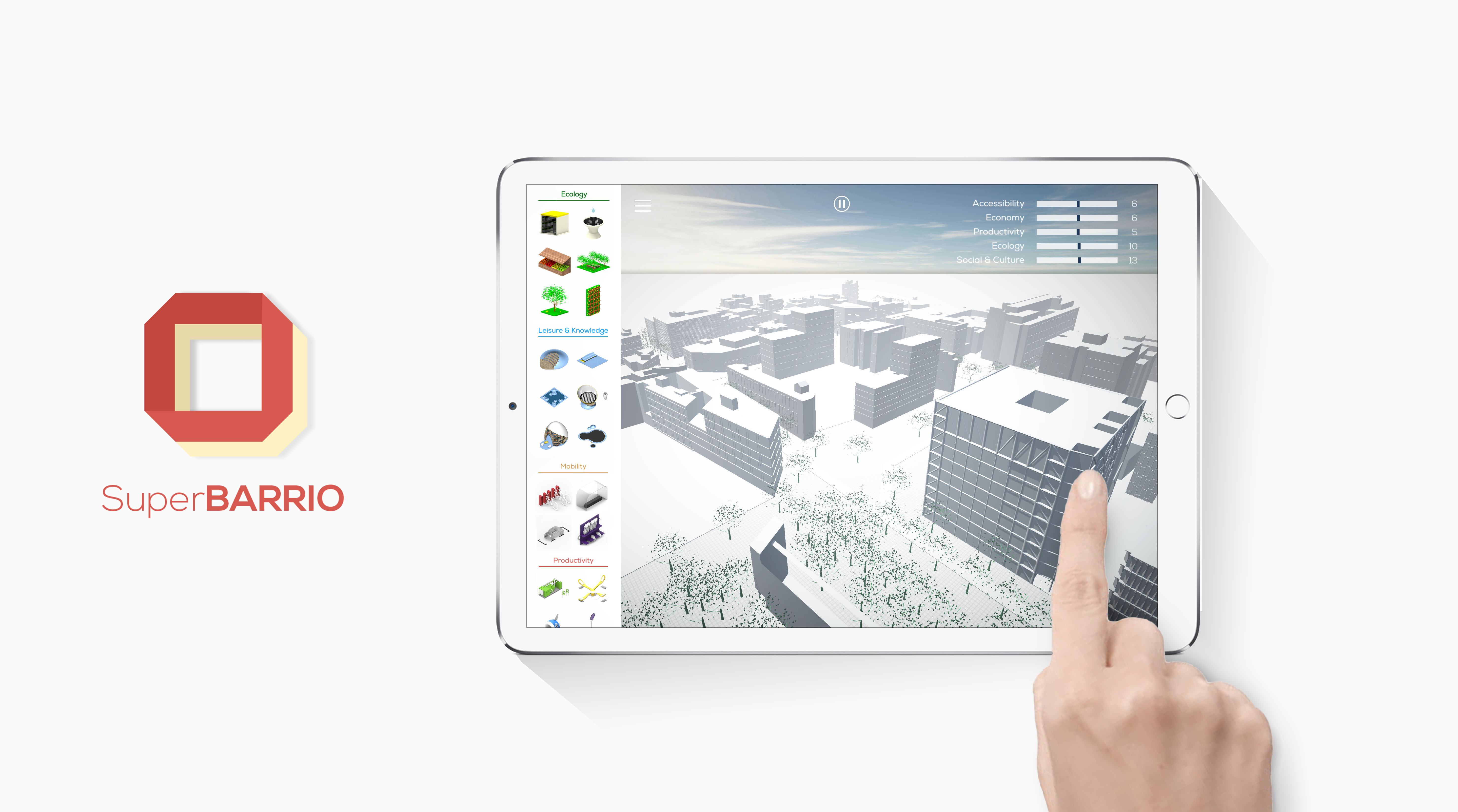
SuperBARRIO- A game app to engage citizens in urban planning
SuperBARRIO is a videogame that boosts participatory design processes Developed as an open source video game…
Other technology and mobile applications have also been used during workshops and summer schools. They are an example of how technology could transform urban planning and design.
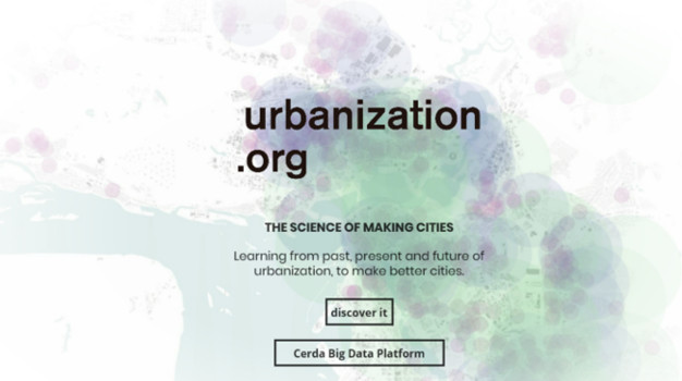
urbanization.org
urbanization.org is an non-profit open platform launched by IAAC that promotes a rational analysis of urban…
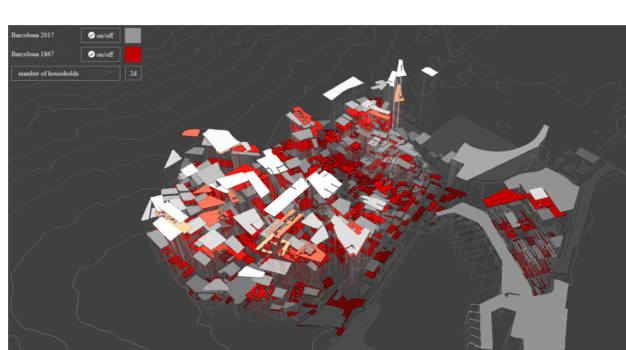
General Theory of Urbanization
1867 Idelfons Cerdà Urbanization considered as a concrete fact Urban statistics of Barcelona For more…
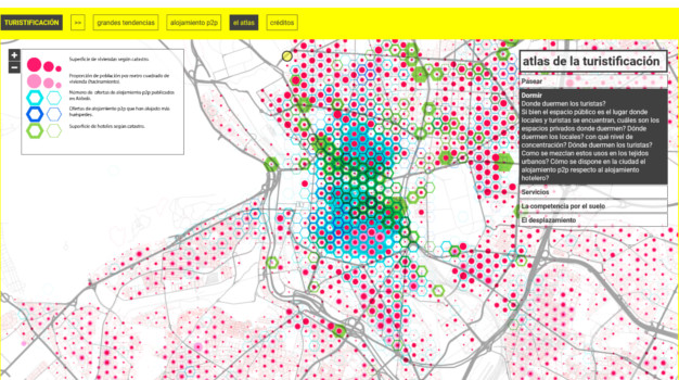
Turistificación
El atlas muestra la distribución espacial del fenómeno de turistificación junto a otras informaciones urbanas…
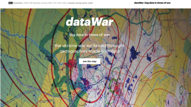
dataWAR | big data in times of war
The ukraine war explained throught cartographies made with data. The overall number of documented casualties…
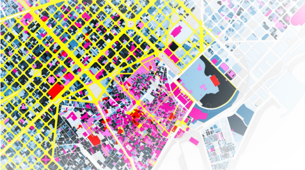
Big Time BCN
BIG TIME BCN is an interactive map of Barcelona that highlights the age of urban…
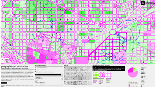
Geographies of innovation
Innovation occurs in education, civic organization and economy as the result of multiple social, financial…
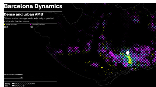
Barcelona Dynamics
Barcelona Dynamics is a collection of maps made with differents kind of data for the new…
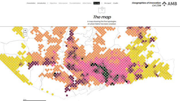
Geografies de la Innovaciò
The study Geographies of Innovation in the metropolitan area of Barcelona (AMB) aims to evaluate…
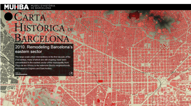
Carta Històrica de Barcelona
The Historic Charter of Barcelona is a pioneering document to explain the history of the…
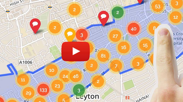
Smarter Engagement
Great places come from understanding and responding to the needs of their people. Traditional consultation can…
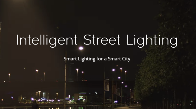
Smart Lighting
Streetlights are a vital part of every city, providing citizens and business with safety and…
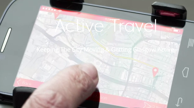
Route planner and real time information systems
An example of real time information is Glasgow's Active Travel Demonstrator. App that aims to…
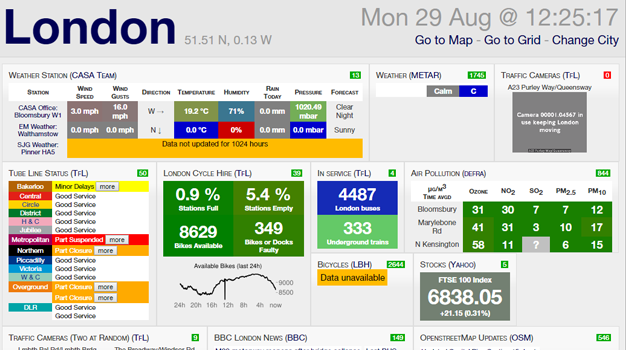
Mapping (real time)
An example of mapping (real time) is the London City Dashboard on microclimate – air quality, temperature http://citydashboard.org/london/…
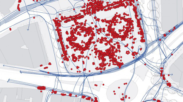
Space Syntax
The network of public spaces in central London between Trafalgar Square and Parliament Square is…
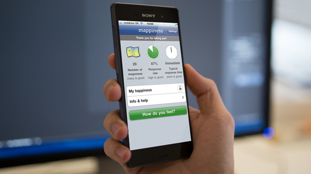
App to map happiness
It's part of a research project at the London School of Economics. Mappiness maps happiness…
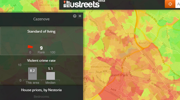
England’s best places to live
An interactive map, coloured, depending on which view you have selected, by standard of living…
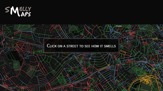
SMELLY MAPS
Think about your nose. Now think about big data. You probably didn’t realize it, but…